AO Edited
Fairview Peak-Dixie Valley Fault Scarps
In 1954, two enormous earthquakes occurred just minutes apart, resulting in prominent scarps that extend for miles along the range fronts.
At 3:08 a.m. on December 16, 1954, the east side of Fairview Peak, about 35 miles east-southeast of Fallon, Nevada, was rocked by a huge earthquake, with a magnitude of 7.2 on the Richter scale. Four minutes and 20 seconds later, a second large earthquake (magnitude 6.9), triggered by the first, shook Dixie Valley to the north.
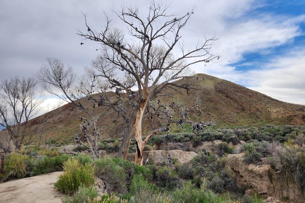
Because of the remoteness of the area, the damage was minor and no injuries were reported. But the pair of quakes left scarps (breaks) in the land surface that stretch for dozens of miles and measure up to 20 feet (six meters) high. Although somewhat rounded by 60-odd years of subsequent erosion, the scarps remain prominent to this day, and even show up on satellite photos. The east (downhill) side of the fault is dropped down with respect to the uphill side, and the offset in Dixie Valley is pulled away slightly, such that the scarp has a trough cross-section in many places.
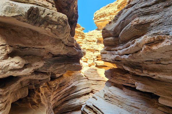
The scarps lie in the Central Nevada Seismic Belt, a north-south trending zone that has been the site of a number of very large earthquakes over the last century. The area has been characterized by ongoing faulting throughout recent geologic time, however, as shown by fault-related features especially along the Stillwater Range on the west side of Dixie Valley. Some of the most spectacular are so-called “wineglass canyons,” slot canyons that taper downward like a wineglass in cross-section. The down-dropping by the faulting has been so rapid that erosion can’t keep up.
Know Before You Go
Some of the fault scarps left by the Fairview Peak event can be viewed off an access road on the east side of the peak, which turns south off US-50 1.8 miles east of State Route 121 (the Dixie Valley highway). It is signed "Fairview Peak Earthquake Faults." Although a graded road, it is steep and can be rough, so that high clearance is desirable. About five miles in, there is a turnoff to a viewing area on the right (west). The viewing area is about 0.6 miles in and, as of April 2023, high clearance is necessary.
Another turnoff to a viewing area is about 0.8 miles farther on the main access road. Here the parking area is about 0.7 miles off the main road.
The Dixie Valley scarps are harder to reach. They run along the west side of the valley at the base of the Stillwater Range, while the main access road, the Dixie Valley Highway (SR 121), runs out in the middle of the valley. Formerly SR 121 was paved as far as the old townsite of Dixie Valley, but it has recently been "de-paved" as a cost-saving measure. The scarps can be reached by a number of primitive roads, but a high-clearance, preferably 4wd vehicle will be required. For distance viewing, the scarps are best viewed in the late afternoon, because the shadow they cast then highlights them.
To reach Big Box Canyon, the most spectacular of the wineglass canyons, proceed 23 miles north on SR 121 from the intersection with US 50, and turn left on a dirt track at 39.617250 N, 118.153126 W. (This turnoff will probably be unmarked.) It's about 1.5 miles to parking at the canyon mouth, overall diagonally to the southwest. The trail first goes west, and then bends south to more-or-less parallel the range front. The parking and turnaround area is within the trough below the western scarp. Location here is 39.611000 N, 118.179920 W.
Some additional primitive access roads are as follows. A road goes to the left 1.3 miles farther north on SR-121, opposite Cattle Road (39.636098 N, 118.151808 W). It goes to Mud Springs and Willow Canyon. Some 2.6 miles farther north, nearly opposite Settlement Road, is a turnoff to East Job Canyon (39.673765 N, 118.143311 W), from which you can then parallel the range front north to IXL canyon, more or less alongside the scarp.


Follow us on Twitter to get the latest on the world's hidden wonders.
Like us on Facebook to get the latest on the world's hidden wonders.
Follow us on Twitter Like us on Facebook